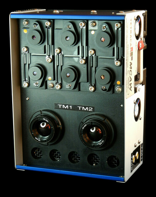
Smart ILS Tetracam's Wireless ILS Calibration Ground Station and Accessory for ADC and MCA Systems Hardware Configuration Software Features System Specifications GPS/IMU Option |
 |
|
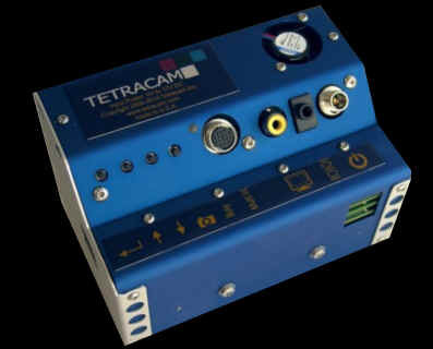
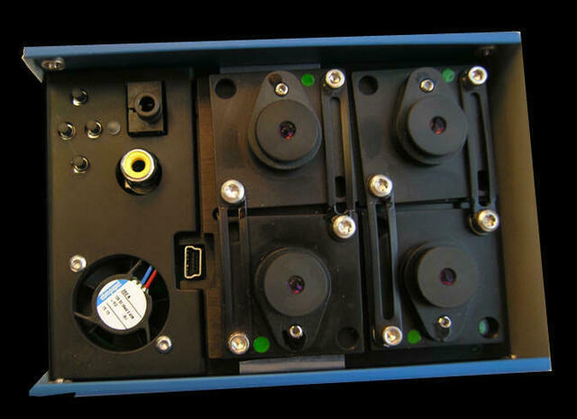
Up to 15 bands of radiometric data collected at 1 second intervals are saved by the Smart ILS in a log file, without errors introduced by platform motion of a UAV. 12 bands can be configured in the field with narrow band-pass filters to match the characteristics of a measurement instrument or camera. The unit is a smart device, equipped with a Wi-Fi network browser interface which allows live display of the data being logged. The wireless interface can be used to retrieve the log file for calibration of images or measurements. The Smart ILS is designed as an accessory for all Tetracam ADC and MCA camera lines, and can be ordered with the camera, or purchased as an accessory for cameras already in the field. Calibration of the system is important, and can optionally be performed at Tetracam when the ground station is purchased, if the target camera can be sent back from the field. The unit has an interface connector with power, ground, and RS232 serial I/O. It is shipped with a 9 volt battery adapter wired to a mating plug. |
|
The time stamps for the measurements in the log file allow the PixelWrench2 log distiller to automatically extract the radiometric data and insert it into the metadata field of images collected with a Tetracam ADC or MCA system. The metadata is then used in PixelWrench2 and other software packages to adjust the pixel values in the image to represent true reflectance and exact color band ratios for vegetation index calculations. |
|
The Smart ILS has a GPS/IMU option available; accordingly, a user of an ADC or MCA system only needs a smart ILS, and they can geolocate their imagery as well as provide ILS metadata and logs. The GPS/IMU data is supplied at the same time as ILS data to the imaging system. When a user is done with an image taking mission, their data will be ready to process in PixelWrench or other software, GPS/IMU and ILS information available either via image metadata or logs. The IMU part of the option consists of heading, pitch, and roll. Since GPS/IMU and ILS information are provided by one device, configuration in a manned or unmanned aerial vehicle will be much simpler than having two devices supplying the information. A user may mount their ILS facing towards the sun, plug it into their imaging system, and images will be geolocated as well as supplied with ILS data. |
| Power | 120 ma at 12 volts, 6 to 24 volt input |
| Weight | 70 grams |
| Environmental | Commercial Temperature / Humidity Ranges |
| Temperature | 0 degrees Celsius to 40 degrees Celsius (32 degrees Fahrenheit to 104 degrees Fahrenheit) |
| Humidity | Less than 85% relative humidity, noncondensing |
| Data Storage | Micro SD memory card, up to 16GB |
| Included Software | PixelWrench2 image processor |
| Host Interface | Ieee80211 wireless and USB 2 networking |
| Command / Control | RS232 I/O for reports measurements Auto trigger mode (continuous capture) Web browser display and user interface |
| Performance | One second measurement rate Up to 12 user selectable narrow band filters One RGB Bayer filter measurement position 16 bit digitizer |
![]()
Smart NDVI cameras are multispectral cameras for precision agriculture that can calculate vegetation indices and create false
color NDVI images without the use of an image processing program accessory.
Precision Farming and Forestry need multispectral camera and NDVI camera images to create orthomosaic maps
that allow interventions to be optimized. NDVI phenocameras that can perform time lapse photography are best for slow growing flora, while faster
growing commercial harvests are best served by airborne NDVI mapping cameras.